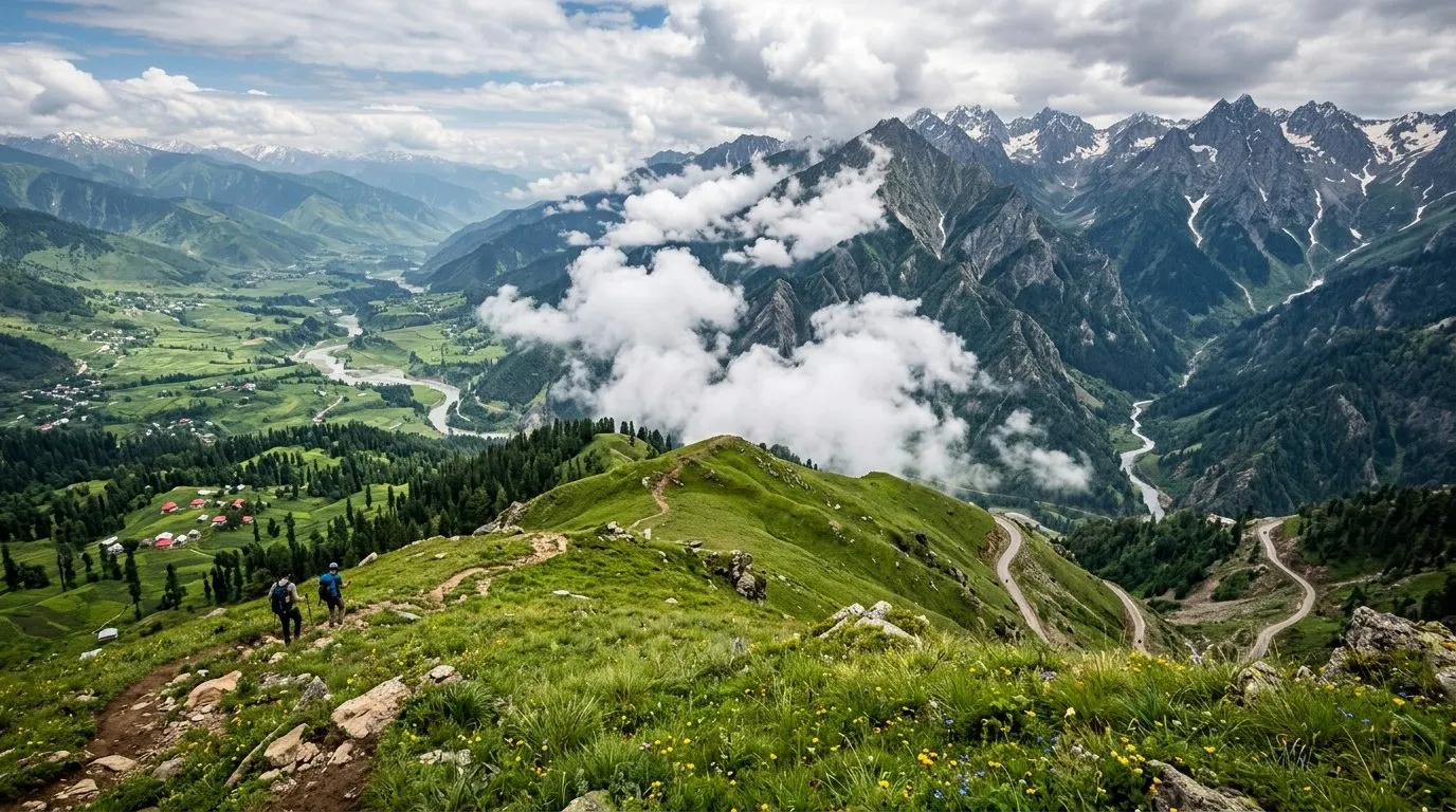
Sinthan Top Kishtwar Face.
Everyone photographs the Kashmir side. Walk 200m to the other edge for the Kishtwar view.WHY NOBODY KNOWS
Completely different landscape — arid Kishtwar valley with snow peaks. Two worlds visible from one spot.
DISPATCH · ISSUE Nº 47
A high pass between Kashmir and Kishtwar where the meadow at the top makes you forget you're on a road.
VERIFIED APR 2026 · ISSUE Nº 47
5 MIN READ·Or skip to the verdict ↓
“A high pass between Kashmir and Kishtwar where the meadow at the top makes you forget you're on a road.”
WHY SPECIAL
Sinthan Top (3748m) connects the Kashmir Valley with Kishtwar. The pass itself is a stunning meadow with views of both sides. Emerging as an offbeat destination — no infrastructure, no hotels, just the road and the view.
Know before you go
Every month rated on the 0–10 editorial scale. Click any cell to read the month-specific verdict — what to do, what to skip, what crowds you'll meet.
↑ Tap any month for the full read · colours match verdict bands
Read our scoring methodology →
ELEVATION
Sinthan Top (3748m) connects the Kashmir Valley with Kishtwar. The pass itself is a stunning meadow with views of both sides. Emerging as an offbeat destination — no infrastructure, no hotels, just the road and the view.
If
You develop a mild headache, nausea, dizziness or loss of appetite above roughly 2,500m within 6–24 hours of arrival.
Then
Stop ascending. Rest at the current altitude for 24–48 hours. Hydrate aggressively. If symptoms worsen or fail to improve, descend 500m and seek medical help. Never ascend further while symptomatic — HAPE and HACE kill quietly.
Full protocol →
If
Your UPI apps return Server Error or Bank Unavailable repeatedly, and no card reader is in sight.
Then
This is the default state in most border valleys, not an emergency. Carry at least ₹10,000 cash in mixed denominations for any trip above 2,500m or off a state highway. Withdraw at the LAST reliable ATM — usually the district HQ — because village ATMs are ornamental.
Full protocol →
Every destination carries trade-offs. The cards below score the practical ones: confidence in the data, kids-suitability, solo-female read, and the emergency floor.
Anantnag→Sinthan Top: 85km 4hrs. Srinagar→Sinthan Top: 130km 5hrs.
Road: Poor to fair. Open Jun-Oct only. Snow rest of year.
Public transport: None. Private vehicle or hired jeep from Anantnag.
Self-drive: 4x4 recommended. Steep, unpaved sections.
₹N/A/night
Self-arranged camping. Some dhaba tents in season.
Emergency: None. Must descend.
Nearest: Anantnag 85km or Kishtwar side 80km
Next: Carry full tank + jerry can
⚠ Carry extra fuel
EV charging: Not available
Freezing even in summer nights. Pass at 3748m. Snow 8 months. Window: Jun-Sep only.
Hospital: District Hospital Anantnag 85km
Police: Army/security checkpoints
Rescue: Army, SDRF J&K
Ambulance: None at pass
Helpline: J&K Tourism: 0194-2452690
WiFi: None
No mobile signal at the pass. Inform someone of your plans before going.
KIDS · FAMILY READ
HIGHLIGHTS FOR KIDS
REASONS
CONCERNS
Kishtwar-Anantnag road pass — drive-through viewpoint, no overnight infrastructure. Day-visit via Anantnag taxi or organised Kashmir tour only.
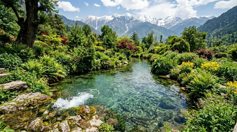
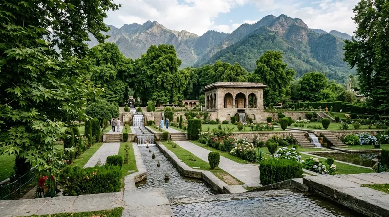
Sinthan Top is a high-altitude mountain pass at 3,748m connecting the Kashmir Valley to the Kishtwar region. It offers stunning 360-degree views of both the Kashmir and Chenab valleys. The pass is surrounded by alpine meadows used by Gujjar and Bakerwal nomads for summer grazing. It is one of Kashmir's best-kept secrets — dramatic views with almost no tourists.
Heavy warm clothing essential — extreme cold and wind at this altitude. UV protection needed. Conservative dress when interacting with nomadic communities.
No food facilities at the pass. One or two seasonal tea stalls may operate in summer. Carry all food and water from Kokernag or Kishtwar.
minimal tourist scams — too remote for organized touts
Cash only. No facilities at all. Carry everything from the nearest town.
very low — Gujjar herders speak Gojri. No English speakers. Travel with someone who speaks Hindi/Urdu.
No mobile coverage at Sinthan Top. Last signal at lower elevations approaching from either side.
Delhi — approximately 830 km by road
Standard Indian e-Visa covers the area. No special permits but road may be closed October-May due to snow. Check road status before attempting. Check travel advisories.
EMERGENCY · SOURCE-VERIFIED
Mountain pass at 12,297 ft connecting Kashmir to Kishtwar. Snow-covered meadows and panoramic views.
HIDDEN GEMS · 3 NEAR SINTHAN TOP
Everyone photographs the Kashmir side. Walk 200m to the other edge for the Kishtwar view.WHY NOBODY KNOWS
Completely different landscape — arid Kishtwar valley with snow peaks. Two worlds visible from one spot.
Three high passes separate Kashmir Valley from Jammu region: Mughal Road's Pir Ki Gali (3,490m) in the north-west, the Jawahar/Banihal Tunnel route in the south-west, and Sinthan Pass (3,800m) in the south-east. Sinthan is the rarely-driven option — it's the only road that lets Warwan and Marwah subdivisions of Kishtwar reach their own district headquarters, and it offers the famous "360 Degree View" point from which travellers can see both Kashmir and Jammu divisions at once. No villages, no commerce, no accommodation at the pass itself — closest stops are Daksum (Anantnag side) and Kishtwar town.
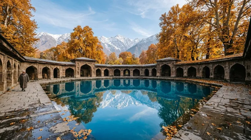
Daksum sits at ~2,400m on the Bringi river, surrounded by some of Kashmir's last intact deodar forest. It functioned for centuries as a caravan rest-stop between Kokernag and Kishtwar — and that role survives today: most road travellers cross Sinthan in one day Anantnag-to-Kishtwar, but break the climb at Daksum for tea and shaded rest. The Reshi shrine inside the forest belongs to the Kashmiri Reshi Sufi order of Sheikh Noor-ud-din Wali, distinct from the Persian Sufi orders found in Srinagar. The deodar cover is what makes Daksum feel cool even in July when the Kashmir Valley below is 32°C.
OR INSTEAD · NEIGHBOURING READS
How Sinthan Top stacks against the closest alternatives.
WHAT A DAY ACTUALLY COSTS
High mountain pass; camping only; no permanent stays; 4WD essential; snow-covered most of year
WHAT CROWDS LOOK LIKE
High pass connecting Kashmir and Kishtwar. Snow-free Jun-Sep only. Very few tourists — mostly adventurers and shepherds.
INFRASTRUCTURE · ON THE GROUND
Anantnag-Sinthan 90km ₹4000.
Transit only.
Cash.
Anantnag.
None at pass.
Kashmiri + Dogri.
None.
HOW TO REACH
AIRPORT
Srinagar (130km)
RAIL
Jammu Tawi
Sinthan Top is a pass, not a settlement. Eat in Kishtwar, 65km out, and carry water and a hot flask for the climb.
3,748m pass between Anantnag and Kishtwar; transit point, no settlement.
Nobody sleeps at Sinthan Top. Acclimatise in Kishtwar, 65km out — overnight at this altitude is medically unwise.
Pass only — no overnight; descend to Kishtwar or Anantnag.
BOOK A STAY · CURATED PROPERTIES
We sit before the booking layer, not beside it — compare prices on the platforms below.
Treks, safaris and day tours — compare on the platforms below.
We don't take payment to feature any destination, stay or operator. Book through a link here and we may earn a small commission, at no extra cost to you. It never affects our scores or recommendations. Editorial policy
LOCAL LEGENDS · WHO MAKES THIS PLACE
Drives the treacherous Sinthan Top pass road like it's his living room. Knows where to stop for photos, where the road is dangerous, and where the snow leopard was last spotted. ₹2,500 for the Kishtwar-Anantnag crossing.
FESTIVALS · BY THE MONTH
Winter celebration at the 3,800m pass connecting Kashmir and Kishtwar with snow trekking, photography contests, and hot kahwa (Kashmiri green tea) stalls.
Pass crossing (3748m) — Anantnag-Kishtwar road connector (summer only).
Lunch packed.
Photo stops. Snow in June unusual.
Descend either side.
If weather turns
Nov-April closed.
Tap any traveler type below to see how this place feels for them.
GO — scenic drive.
Best for
Anantnag to Kishtwar summer route — shorter than Jammu-Srinagar NH44
Best for
3748m pass retains snow into June — rare summer-snow tourism
Best for
Kishtwar-side meadow via Sinthan — alternative to Kashmir Valley gulmarg
Best for
Increasingly popular with Indian paragliders — J&K Tourism promotes
ALSO ON NAKSHIQ
Guides
Everything the guidebook won't tell you — written for India in 2026.
Blog
Long-form reads on regions, festivals, and the offbeat circuit.
Road trips
Driving itineraries with day-by-day stops, distance, and difficulty.
Collections
Wettest places. Sacred lakes. Solo-female-safe. Curated cuts.
NakshIQ 100
India's highest-scoring places, ranked across all 12 months.
The Window
One honest spread, every Sunday. The full back catalogue.
Skip list
Overhyped places with honest alternatives.
First trip
Safety, scams, what to wear, food survival, solo female travel.
FEATURED IN COLLECTIONS
Cliff edges, no barriers, single lanes, and scenery that stops your heart.
Skip the Instagram spots. These are places most Indians haven't visited — raw, quiet, and unforgettable.
Where BSNL gives up and even God checks voicemail. These destinations force you to look up from your screen.
— The NakshIQ editors
TRAVELLERS' VOICE
SHARE YOUR EXPERIENCE
ASK A QUESTION